window.dataLayer = window.dataLayer || []; function gtag(){dataLayer.push(arguments);} gtag('js', new Date()); gtag('config', 'UA-102101132-12');
Loading...
/GPS Routes
GPS Routes2021-06-11T11:58:55+02:00

GPS Routes
Enjoy the best routes, whether on horseback, bicycle or on foot.

Separador titulos

REGO DE PEDRA

Route Rego de Pedra
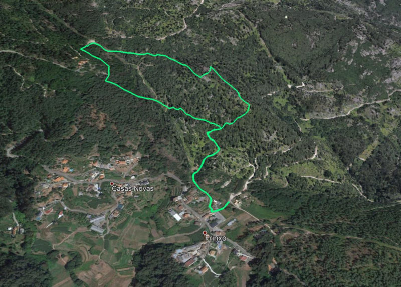
  • Total length: 2,98 km

  • Maximum height: 423 m

DOWNLOADS

GPX
KMZ
SEE on WIKILOC

CAPELA DE SAN XULIÁN

Route Capela de San Xulián
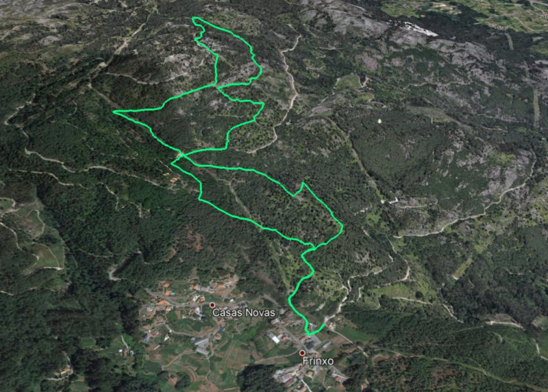
  • Total length: 6,66 km

  • Maximum height: 609 m

DOWNLOADS

GPX
KMZ
SEE on WIKILOC

BODEGA REMESAL

Route Bodega Remesal
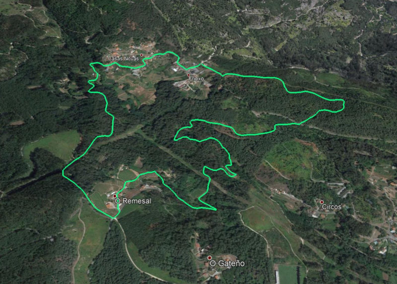
  • Total length: 6,63 km

  • Maximum height: 270 m

DOWNLOADS

GPX
KMZ
SEE on WIKILOC

MUIÑOS DO TRIPES

Route Muiños de Tripes
  • Total length: 5,5 km

  • Maximum height: 248 m

DOWNLOADS

GPX
KMZ
SEE on WIKILOC

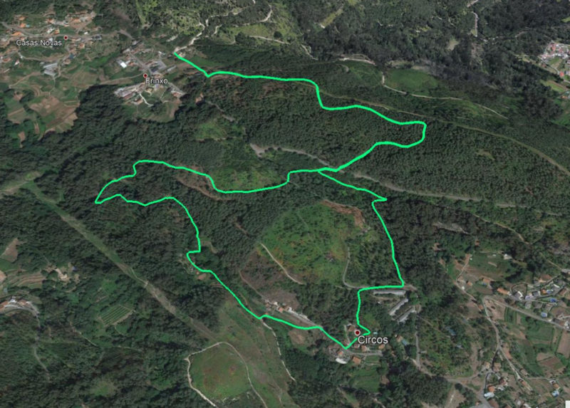
MUIÑOS DO TRIPES (START CIRCOS)

Route Muiños de Tripes (start Circos)
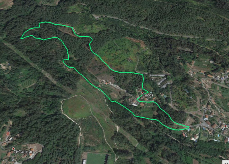
  • Total length: 2,85 km

  • Maximum height: 183 m

DOWNLOADS

GPX
KMZ
SEE on WIKILOC

MUIÑOS PEREDES

Route Muiños Paredes
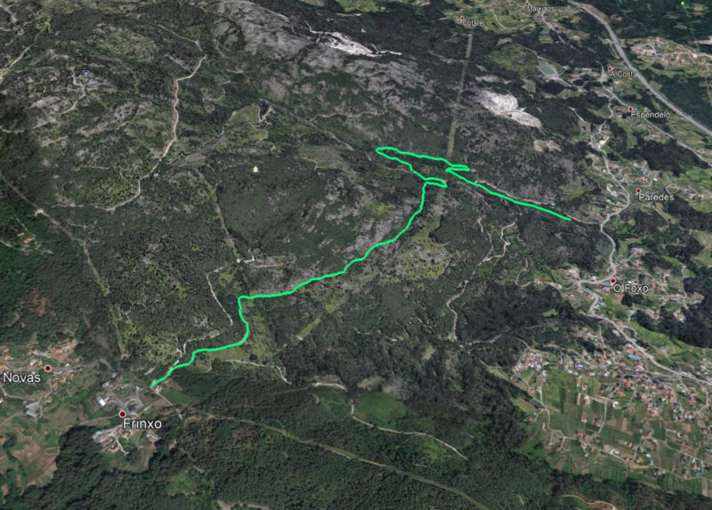
  • Total length: 3,75 km

  • Maximum height: 258 m

DOWNLOADS

GPX
KMZ
SEE on WIKILOC
This site uses third party cookies to obtain anonymous statistical information from its visitors, so that the publisher can know your preferences when interacting with our site by measuring audiences and analyzing user traffic. See what a "cookie" is, what is used on this site and, if you agree with our "Cookies Policy", click on ACCEPT. You can also choose to reject their installation and, at any time, accept them again by accessing the aforementioned "cookies policy" that you will find permanently at the bottom of this website. Cookies settings Accept

Google analytics

Analytical Cookies third party and persistent cookies, not strictly necessary for the publisher (information society service provider) to provide a service expressly requested by the user.

Function and purpose: these cookies generate an anonymous user ID, which is used to count the times a user visits the Web Site, as well as when was the first and the last time the user accessed it. It also calculates when a session ended and can detect the origin of the user and keywords they have previously used.

Check box marked for "ACCEPT", unchecked for "REJECT".

Google Maps

Third party cookie, technical, persistent and strictly necessary (no need to consent to installation). It only provides the spatial location of the user.

Check box marked for "ACCEPT", unchecked for "REJECT".